It’s one thing to see a block on a map, and another to examine a building up-close.
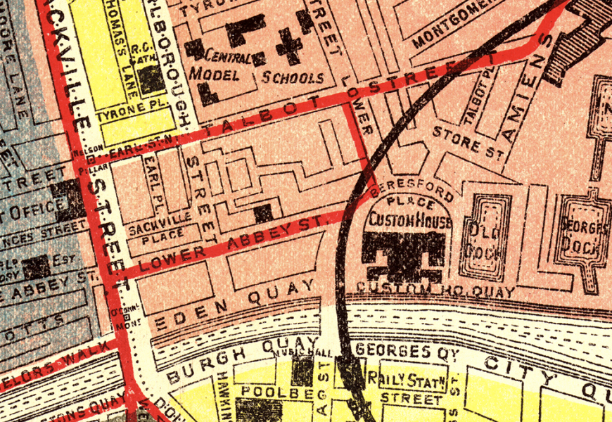
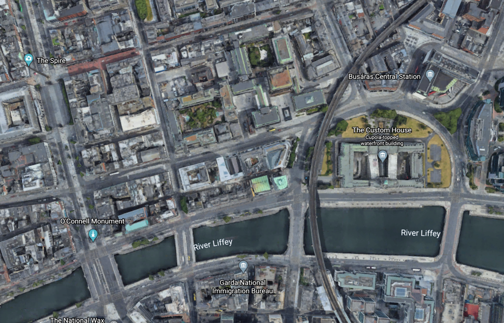
As detailed as Thom’s 1904 map of Dublin is–from afar, it’s a complex and highly organized representation of the city–it misses something that Google Earth’s photographic reconstruction of Dublin has. With Google Earth, it’s much easier to get a sense of the urban environment: the River Liffey is a murky blue-green, the buildings are more cramped than they appear on Thom’s map, and the landscape is washed in a dull set of grey.
It’s a sharp contrast to the bright yellow and red of Thom’s illustration. Thom makes the city look orderly, like the city is somehow easy to categorize and subdivide. Thom notes that there are 20 wards, and has highlighted them in various colors to distinguish them from one another.
Google Earth lacks this organization. Even this small section of Dublin blends together in low saturation. Details are evident but indistinguishable–there’s only so far you can zoom in on the digital map. It may have dimension, but it can’t show everything.
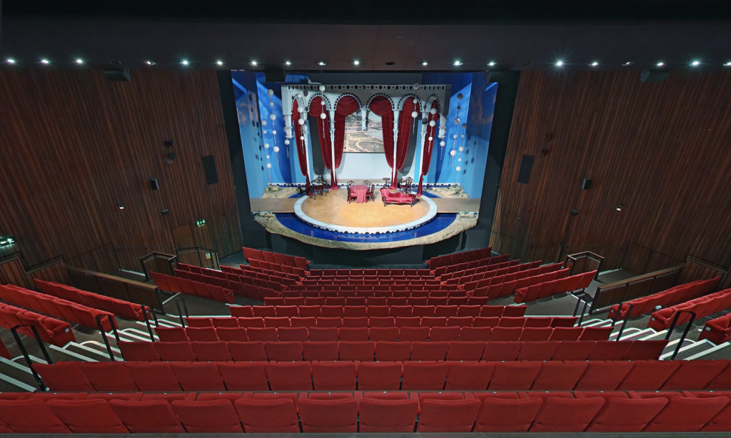
Stepping into the Abbey Theatre, I was overwhelmed by the contrasting high-level of detail that Google Maps could provide. Though the Abbey stage appeared cramped, the set was beautifully decorated in vibrant colors and architecture.

My journey from the highest frame of Thom’s 1904 Map to Google Earth’s limited exterior observation to the photograph of the Abbey Theatre’s stage had me realizing how much detail is truly involved in a city–especially one with as rich a history as Dublin.
There’s only so much each representation of the city and its features can reveal. Thom’s Map favored a broader scope to focus on organization while the photograph of the Abbey stage allowed a more tight view of a single room within the city.
I was reminded of Sean O’Casey’s play Juno and the Paycock–in part due to the theatrical nature of the site I visited and due to the play’s urban setting. While O’Casey only showed the private life of one of Dublin’s families, he was still able to give present his observations of the social conditions of the city of the whole.
Like the photograph of the Abbey stage, the play is a tight view of a broader context. But an examination of its details reveals a rich and elaborate story of its own.


Hello Michelle!
Your post was so engaging, when I got to the end I was somewhat sad because your train of thought and connections were very interesting; I wanted to keep reading! I really like your analysis of the two maps and how you identified key differences between the two. I agree that Thom’s illustrated map is much more interesting and comprehensive. It reminded me of how Joyce sought to recreate all aspects of Dublin in his work. He even said that if the city ever burned down, you could rebuild it using his work Ulysses. Old manuscripts and maps of Dublin give us a perspective that modern reinterpretations can’t.